The Backbone – Pennine Way via SPINE ROUTE Edale to Kirk Yetholm 12th – 18th Jan 2024
Many of us have a sports plan at the start of every new year of what we would like to achieve. Needless to say this can be disrupted by illness, injury, work and life in general but sometimes the desire to execute the plan is so great you just have to push through these obstacles and mental doubts and just have a stab at it. The Pennine Way in winter, solo and unsupported was such a plan and this is an honest account of the challenges faced.
The physical impediments I had, were twofold: firstly, to make it happen despite having training that was interrupted by illness and a supressed immune system (Double viral hit contracted from air travel during two earlier trips to Spain) and second, to overcome a chronic knee injury which had emerged during an otherwise enjoyable Cheviot Goat Race earlier in December. The injury and illness also meant that my ability to recce the route was somewhat curtailed and limited to three northern sections.
The Start in Edale
The other drawback I faced was the logistics of a fast(ish) paced attempt. Apart from the mandatory safety kit and medical pack, I didn’t want to carry anything I couldn’t eat, drink or wear and this meant finding suitable accommodation up the route which proved to be an unexpected challenge. Logistics are exacerbated in winter as much of the bunkhouse, B&B and campsite accommodation is shut.
It ultimately dictated the length of my adventure as I struggled to make a sub 6 day trip work given that a lot of the accommodation options are unevenly spaced and/or annoyingly off route and resulted in an unbalanced plan with short days followed by massive expedition days which meant success would be more exposed to impediments of the weather and my current physical capabilities. This helped me decide a sub 7 day expedition would be the way to go (better for the knee recovery) and I have to be sensible once in my life. So that was set and the sub 7 day plan locked in. What it lacked in flexibility it made up for in practicality providing hot and cold food supplies and a chance to dry kit and recover.
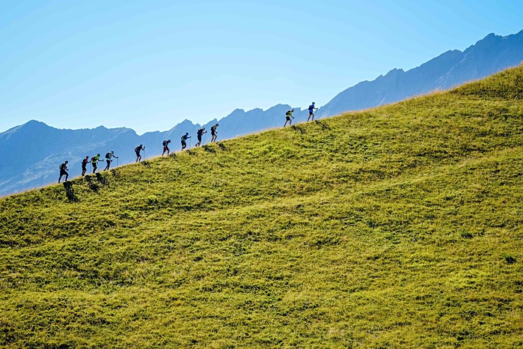
A solo journey is by its very nature a lonely experience and that prickled a bit. Sharing an experience, especially one as ambitious as this, enhances any achievement for me. I’m not a team player but I embrace partnerships and soulmates in sports I love (Rock Climbing, Diving, Mountaineering, Hill Running) and I hatched a plan that would partly satisfy this need. I had managed to recce three of the northern sections of the route with some 2024 SPINE competitors, Scott Brown, Mike Gregory, Orran Smith, Nikki Arthur and a noncombatant, Max Saleh. They were all much faster than I and I elected to overlap my Pennine Way journey with the SPINE race timetable in the expectation that they would catch me up before I finished. Excellent plan.
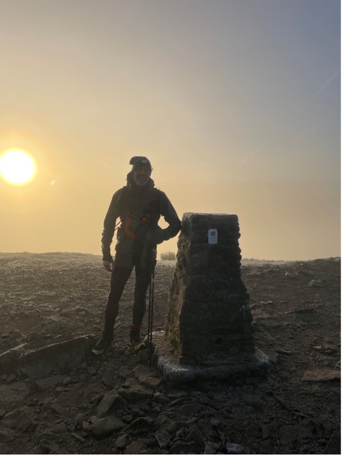
Pen-Y-Ghent at sunrise
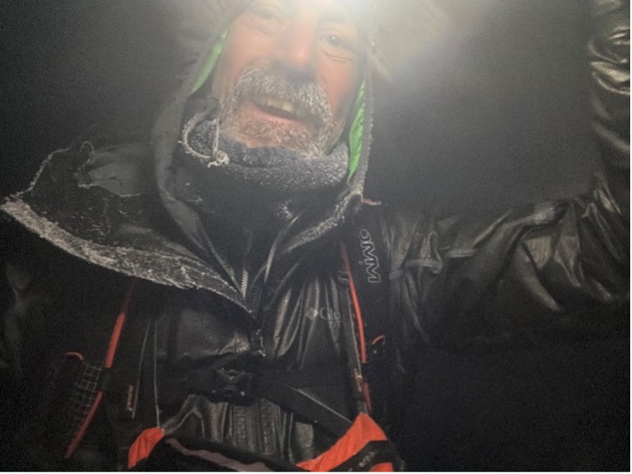
After the usual kit faff, I packed my 25 litre sac which weighed in at 16lbs (7.2Kg) including hill food and some liquids (but not packed lunch) and headed north to Kirk Yetholm on the 10th Jan for an overnight stay and to leave my van at the finish line. I discovered while en-route that I had left my Suunto 9 watch charging back in Warwickshire so I hastily arranged for a work colleague who lived nearby to meet me with it when I arrived by train to Edale from Berwick on the 11th Jan. I stepped off the train with Tim Laney and walked into Edale. Tim had arrived prior to the race start to assist in the hill support team setup for the SPINE and we discussed possible route diversions before going our separate ways.
The Journey
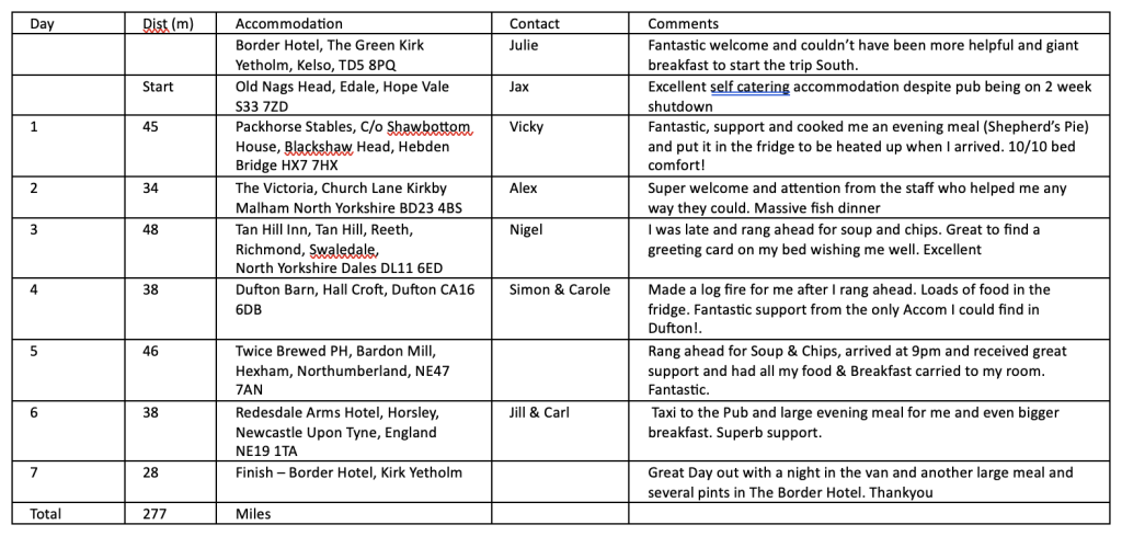
Day 1, 5am start – Edale to Hebden Bridge (45 miles, 5860ft ) 14hrs 31min
Up at 4am and 7 weetabix, 2 pints of milk, 2 pots of tea, 1 banana and a strawberry yoghurt later saw me stood in front of the Pennine Way gate with the faded pictorial map of the Pennine Way route embossed in white. The usual feelings of dread, excitement and an overwhelming desire to get going saw me crunch up the rising path towards the black mud of the Kinder Plateau and ‘Dark Peak’ which was very dark at the time and unhelpfully cloaked in Clag. A slow start and the steady climb helped bed in the legs, something that was to become a daily ritual allowing me to warm up the limbs to find my ‘dog jog’ pace on the flat of the upper paved moorland areas and I covered the ground easily.
I descended to Torside Reservoir and met a fellow traveller and Bob Graham completer Jonny Shaw (Bob No561), he was my age and sporting a large sac and told me after his heart attack he decided to do a winter Pennine Way Solo trip camping, which put my effort into perspective somewhat. Fingers crossed he managed to finish? I maintained a relaxed pace over Marsden Moor and Black Moss to Hebden Bridge and my overnight accommodation at Packhorse Stables 3 miles out of Hebden, where the owner Vicky had made me an evening meal and left it in the fridge. A long but enjoyable first day.
Day 2, 7am start – Hebden Bridge to Kirby Malham (34 miles, 3963ft) 11hrs 8min
This was one of the shorter days planned, and provided plenty of runnable, but generally deserted, high moors. The descent into the valley towards Kirby Malham crossed gated farmland and cow churned grass/mud fields that were now frozen solid and resembled a field of ankle turning half bricks. That’s when I started to realise that unfortunately this farmland terrain would be a recurring feature of this trip.
I left the Pennine Way to travel the mile or so off route to my accommodation for the night and a fantastic evening meal with beer! I also decided after experiencing a couple of internal ‘pinches’ from my left knee that it was probably a good idea to tape it up with KT tape, something I discussed with a Physio friend and along with an ice pack provided by the pub it proved to be a very effective maintenance solution. The Victoria Pub staff very helpfully provided me with a loaded breakfast tray for the morning because the next day would be my longest on route.
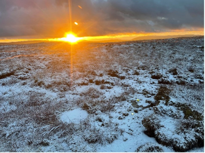
Pen-Y-Ghent Summit at dawn
Day 3, 4.15am start – Kirby Malham to Tan Hill Inn (48 miles, 6762ft) 16hrs 15min
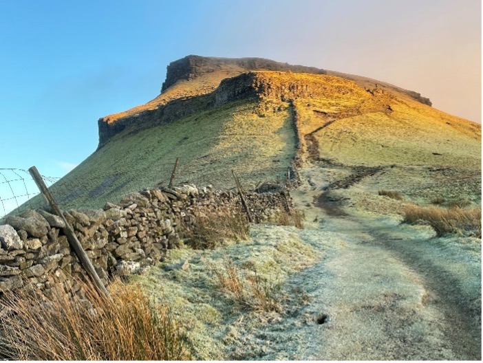
My longest distance on paper and travelling through some spectacular scenery (Malham Cove and the tarn) neither of which I saw as it was dark, probably a good idea as the last time I was there in 1986 Malham Cove was the scene of a nasty climbing accident that was the root cause of the chronic state of my left knee. For the first time I met and chatted to a SPINE checkpoint Marshall out guiding runners with a torch but explained that I was not in the race (something of a recurring theme of the journey). At the 10 mile mark I was treated to a spectacular sunrise as I ascended Pen-Y-Ghent. It was to be the best feature of this trip as early starts and late finishes were guaranteed to deliver the most amazing colourful winter scenes.
I descended into Horton and stopped for a 15 min food break to cram in the calories for the next long runnable section to Hawes and a quick catch up with Debs White who was running the SPINE checkpoint there. As sunset arrived on Great Shunner Fell I made the best of that fading light and ran the frozen pavement into Thwaite, onwards past Keld and up the squelchy, partially frozen Stonesdale Moor.
A fully illuminated Tan Hill Inn came into view about a mile ahead and I hoped they had saved me some food as it was getting late. As I checked in at the bar I met SPINE Hill Safety team member and previous podium finisher Lizzie Faithful-Davies and compared notes on the route and brilliant weather. Soup, beer and chips consumed I retired to my room to find a greeting card from the Tan Hill staff on my bed wishing me well in my solo journey which was gratefully received. Thank you.
Going over Great Shunner Fell
Day 4, 6am start – Tan Hill to Dufton (38 miles, 2497ft) 12hrs 30 min
A -6C start was just perfect for the permanently wet Sleightholme Moor section. I dog jogged to Middleton–in–Teesdale and along the picturesque trail next to the River Tees passing Low and High Force waterfalls and heading West on to Cauldron Snout which was spectacularly in full spate. The weather was just fantastic and I crammed food in to give me an ‘hour of power’ uphill to High Cup Nick.
I (again!) missed sunset but got a great shot of the dying sun with the moon above. I descended the steep rocky trail to the Potting Shed in Dufton, picking up a niggle by over reliance on my right leg to control speed on the decent to an awaiting log fire and a fridge full of food prepared for me by Simon and Carole the owners. Once settled, I also checked the Open Tracker Spine link for my friends on route now and hopefully catching me up.
Day 5, 3.55am start – Dufton to Twice Brewed (46 miles, 5945ft) 17hrs 10 mins
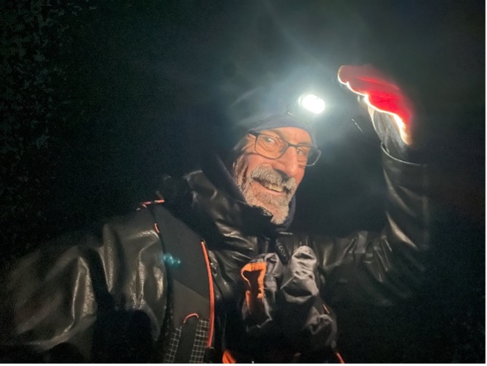
With hindsight, this was my worst day on the hill. It started off with an enjoyable night hike up and over Great Dun Fell and Cross Fell which at the time had variable conditions, pretty good viz and -15C windchill and I met several other Spine parties on this section. It was icy as hell and somehow I managed to deck it hard and whack myself round the back of the head with my walking pole, at the same time puzzling and painful. I stopped off in Greg’s Hut for a few minutes warm up and get some warm water to unfreeze my drink bottle before dog jogging on down the iced up track passing Debbie Martin-Consani on her way up from Garrigill.
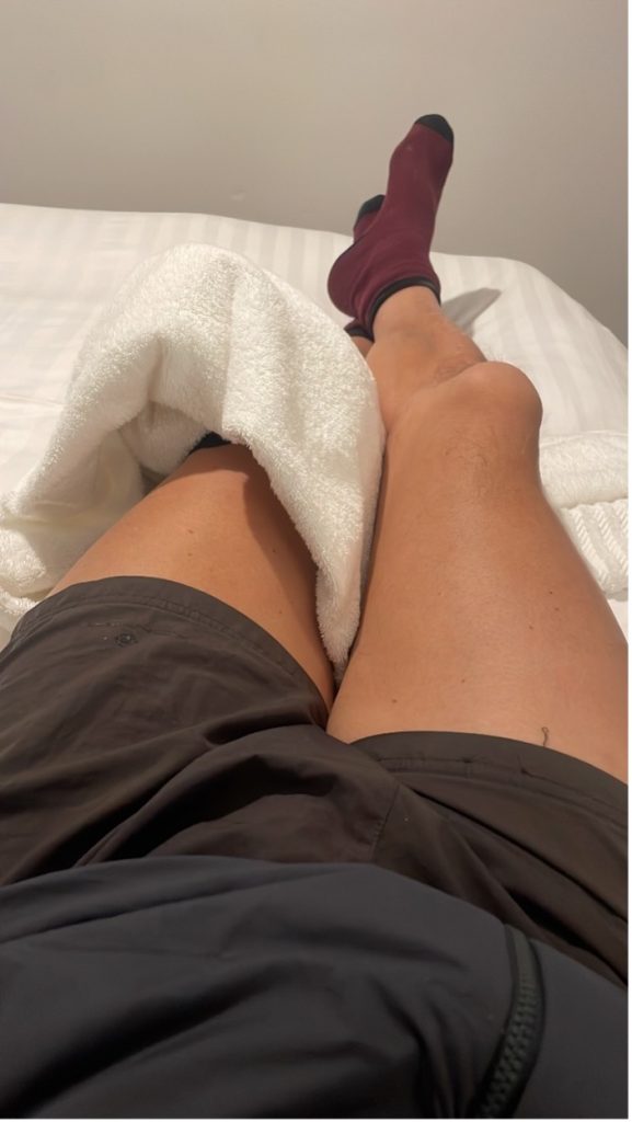
Ice Packs on the left knee from day 2; as if it wasn’t cold enough during the day!
At the Alston checkpoint (‘I’m still not in the race…’) I ran onto the petrol garage 200m up the road from the route for a couple of pints of energy boosting milk. I also met my friend Paul Nelson 15 minutes later heading away from Alston. He was going well in the Northern MRT Challenger event and I didn’t have the pace to keep up and talk at the same time. (I later found out he won the event, well done Paul!). The snow started about now and covered the tracks across the frozen, churned up fields and obscured the view of the route so picking out the Pennine way stiles and gates was challenging all the way to Hadrian’s Wall. The route didn’t ease off when darkness fell and the last 6 miles along the wall to the Twice Brewed Pub took me 3 hours.
I hadn’t recced this section and was frustrated by the lack of wall, the undulating terrain, and the myriad of confusing sheep trods. It was a great relief to see the light from the Pub a mile or so in the distance. They had saved me a large amount of hot food and gave me a massive breakfast tray for the morning. The staff were brilliant and I quickly ate and did my kit admin before hitting the sack.
Day 6, 6.20am Start – Twice Brewed to Byrness (38 miles, 4426ft) 12hrs 35min
The weather on this section was amazing, bitterly cold -6C and prompted my decision to finish the nice bit of the wall following the SPINE GPX rather than taking the shorter route along the official Pennine Way. The main part is across common land into Bellingham and when I was jogging along the road past the lane leading to the Bellingham Checkpoint I heard shouting. I couldn’t see who it was at first but heard a familiar voice from Orran Smith a SPINE recce partner and we joined up for the mile or so into Bellingham swapping stories about the trail and his partner Nikki Arthur who had already won the Northern Challenger Female race by a 10 hour margin and came in 3rd overall. She was waiting for Orran at the finish so he didn’t want to hang around.
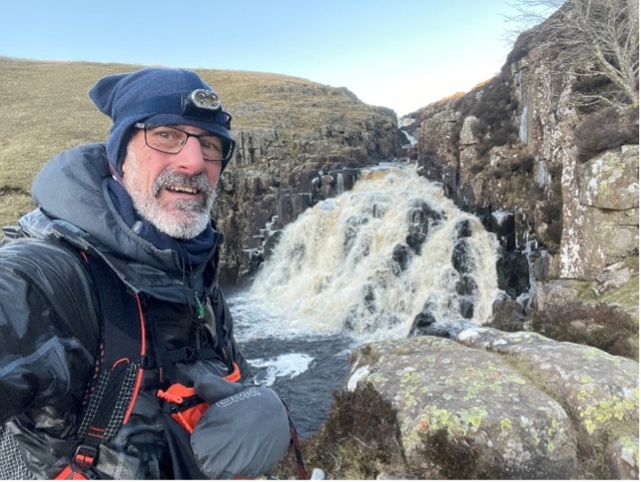
Cauldron Snout
I headed for the Co-Op shop to buy a couple of pints of milk and he headed up the hill. 15 mins later I rejoined the route and was treated to a superb run across Troughend Common, a section we had both recced during storm Gerrit a few weeks earlier. The conditions couldn’t have been more different and I caught up with Orran again as night fall arrived, on the fire road trail through Redesdale Forest. I had to call ahead at this point to confirm a 7pm meeting time for my taxi as there was no accommodation in Byrness so I had to travel out of town.
At the trail junction where the SPINE route heads towards the Checkpoint I said goodbye to Orran on his final leg to Kirk Yeltholm and took my 20 min taxi ride to the Redesdale Arms, where I was well looked after, fed and watered by the landlords’ Jill and Carl. An epic day on the hill. PS: Orran never mentioned it but he proposed to Nikki on arrival at the finish line. He was carrying the diamond ring in his rucksac. PPS: Nikki said YES!
Going over Cross Fell, -15C wind chill
Day 7, 9.30am start – Byrness to Kirk Yeltholm (28 miles, 4111ft) 8hrs 40min
A spectacular day and due to my taxi’s school run commitments I had to suffer my first full cooked breakfast of 6 poached eggs on toast, cereal, yoghurt and fruit with a gallon of tea at my B&B. This was my shortest day and I was running into a bit of form. It appears that on these multi day events I tend to get stronger as the week goes on and this trip was no exception. I was dropped off at 9.35am and headed up towards Hut 1 where I stopped to chat to marshals’ Drew, Chris and Cathy and have a drink and eat some food. It turns out that there were SPINE runners just ahead and I met them as I got to Mozie Law along with Northumberland MRT member Damien.
I jogged ahead to Windy Gyle and met some other MRT Marshal’s near Kings Seat who said the 2nd and 3rd placed SPINE ladies were just ahead and that one was suffering from sleep deprivation. I said I would check on them if I caught them up. A mile further on I passed Hannah Rickman and she said she was taking it steady but was fine before shortly after coming across Lucy Gossage who informed me she was basically falling asleep on her feet having not really slept for the whole race. The night before I had met her dad in the Redesdale Arms and he mentioned Lucy’s sleep deprivation. I stayed and chatted to her till the path headed down west to Hut 2 as I wanted to nip up ‘The Cheviot’ to finish my Pennine journey.
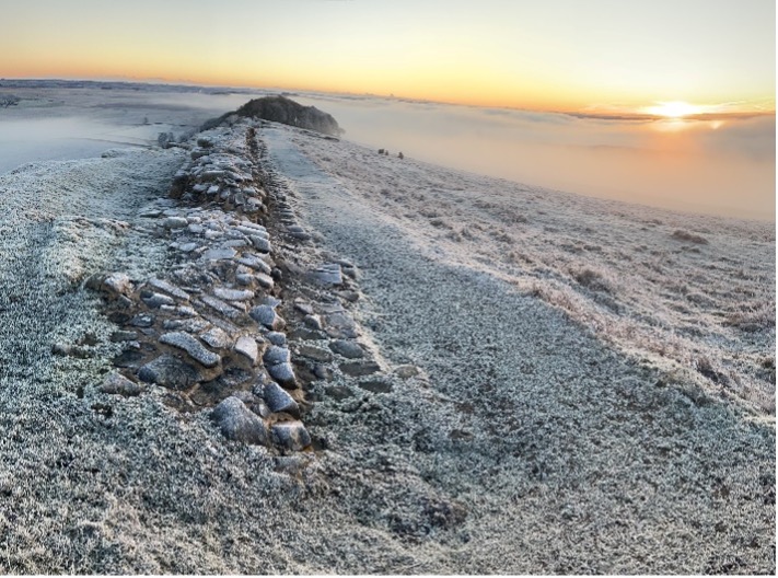
End of Hadrian’s Wall at Dawn
I told Lucy I would try to catch her up on the run in. Although not on the official SPINE route The Cheviot top was amazing, breezy, cold and crystal clear so, a quick photo and a video for the Dragon’s Back pals back home and a run down to Hut 2 where I found Lucy had been safely buddied up and had already departed for the run in. I descended fast from the top of the Schil in fading light and heard a yell from the trail ahead.
I found Michael Kelly on the floor 40m in front of me. Lucy had run on ahead several minutes prior. Michael had taken a heavy fall on sheet ice. The main concern was his leg got awkwardly twisted up his back as he fell, but as we talked and he sat upright, time worn on a bit and it started to feel a bit better. It was getting pretty dark so I helped him sort out his head torch and checked he could walk down ok, we cautiously paced out a couple of hundred meters downhill and he said he was now able to move ok so I said goodbye and ran on to see if I could catch up with Lucy.
I saw her headtorch light just as we hit the tarmac road and we walked/ran in the last 3 miles or so chatting to pass the time and in anticipation of her grand stand finish. The cheering was audible 300m from the line and I peeled off right to touch the wall while Lucy enjoyed the SPINE family reception. I informed the SPINE hill support team of Michael’s tumble so they could check he was ok and dumped my kit in the van and headed to the Pub for a large drink and an even bigger Border Hotel dinner. Total journey time taken 6 days 13 hours.
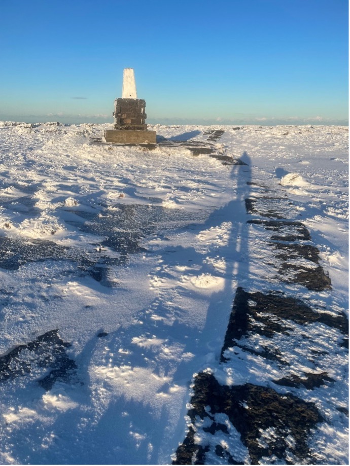
The Cheviot summit.
OBSERVATIONS
Oh, I was lucky! Yep, for once the weather sprites were looking the other way when I made this plan. The weather window I had was perfect for me. On reflection, three main differences emerged between my solo journey and that of my friends in the SPINE race, so in no particular order. First, mine wasn’t a race and I could relax into a pace and thoughts without the anxiety of thinking about the end, placing or results.
The challenge was the route itself not the order or time of finish. It was a holiday on the hill and I treated it that way. Second, sleep deprivation. Its clear this has a massive impact on performance and my 3 – 5 hours of admittedly fitful sleep a night was a luxury the SPINE contenders couldn’t achieve, even if you chose to bivi away from the checkpoints. The extra sleep gifted me the ability and cognition to appreciate the journey north. Third, food, every night I had a choice of food from a menu and time to eat my fill. My nutrition plan at the end of each day and on the hill was basic but it worked and I now have a new found plan to carry me through other winter projects to come. A great learning experience. Great accommodation, food and weather, what an adventure! Do it.
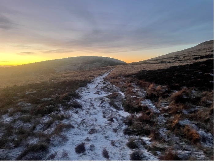
Final few Miles descent into Kirk Yetholm
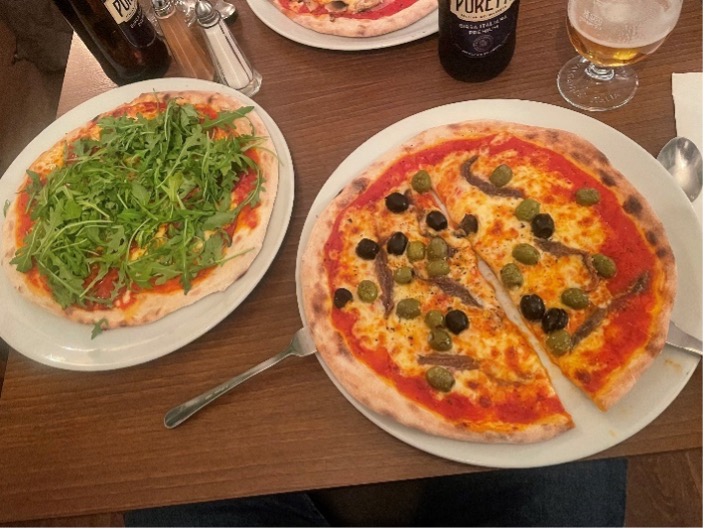
Back to Penrith and 2 pizzas to finish!! Hurrah! XXX
SUPPLEMENTARY INFORMATION
Montane Winter Spine Sprint Race Report