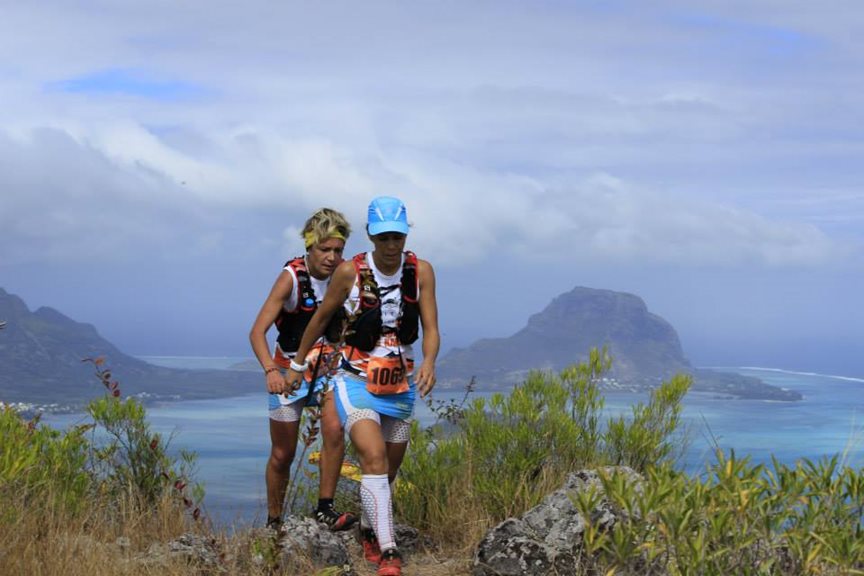
There’s something really aesthetically pleasing about crossing a mountain range from sea to sea, and this uniqueness always brings me back to the Pyrenees. They are the perfect European mountain range, just hitting altitudes high enough to hold some glaciers and have alpine terrain whilst being less serious than The Alps. The Haute Route Pyrenees (HRP) criss-crosses the border between Spain and France and takes in some of the most dramatic scenery over its 750 km of tracks, trails, scree, boulder fields and unmarked high mountain passes, accumulating around 40,000 m of ascent on the way. It shares some sections with the GR10 in France and the GR11 on the Spanish side.
In 2020, I set the record on the former in a self-supported style, carrying all my own equipment, only resupplying or using services on the route and without any external help or support. I couldn’t wait to get back out on the HRP which would undoubtedly offer a much more involved and challenging adventure, taking in considerably higher mountain terrain and sections more akin to mountaineering than running.

Pre-dawn on the 13th of September was windier and colder than I’d have liked on the Atlantic coast as I ran through the rolling hills of the Basque Country, hoping to avoid the Russian roulette of falling chestnuts, with spiny pods like sea urchins, thudding as they hit the ground around me. The changing of the seasons was evident and something I’d rather foolishly overlooked in my planning. I’d spent the previous year obsessing over routes and optimising equipment after my GR11 run. I settled on a route that would stay as high as possible for speed – and with no detours into towns – only resupplying on the route itself. This was just about possible with around 230 km and 200 km being the longest sections without a shop. I decided it was best not to plan my itinerary day by day and go by feel, and with my new tarp I could camp up wherever I needed to.
I made good speed through the first 80 km, with resupply number 1 at 50 km. By the end of the first day, I found myself searching for a hut in the driving wind and rain in a full-on gale on the site of an ancient hill fort. In my haste to rest I made the bad decision of pitching the tarp on top of the hill with limited protection in between grassy mounds. Several times during the night the tarp blew over and pegs ripped out, leaving me scrabbling around in the tempest looking for the pegs whilst taking a full soaking. The flapping of the tarp kept me awake most of the night and to add insult to injury, I found the mountain hut the next morning about 200 m further down the hill!

Within 3 days I’d covered the first 200 km and made it to the start of the central Pyrenees. The Pic du Midi d’Ossau stood foreboding above an early morning cloud inversion, the beauty of which was short-lived. I descended into the cloud and stayed there for most of the day. The wind persisted along with sustained periods of rain, which were mentally draining and made navigation somewhat difficult. What was noticeable was the temperature drop at night in the high mountains. My zero-season sleeping bag – for all its appeal at only 225 g – suddenly seemed like a miscalculation when combined with an equally light air mattress that offered very little in the way of insulation. Nights under the tarp typically consisted of sleeping until about 3am and then waking up freezing and doing some core exercises, trying in vain to warm up before the alarm went off at 5 am.
In stark contrast to the oppressive days of rain, the sunny days reminded me of why I was there, and it was a joy to experience the mountains from dawn till dusk in all their splendour. One such day started in a high rocky cirque with scree made up of football-sized blocks dropping away into the darkness. Suddenly, something took off down the slope like a ton of bricks and I immediately froze. It was impossible to make out what it was, but it must have carried some weight and power to fly down the angular scree so quickly. Moments later another animal cast off down the mountain and I could just make out a black shape moving off to the right to meet the first one. Had I just crossed paths with the elusive European brown bear? My overactive imagination raced while I quickly made away from the scene to the next coll and over to the north face of Vignemale (3298 m).

This Pyrenean giant has inspired alpinists and mountaineers since the early pioneers of Pyrenean exploration and it’s easy to see why. Its walls rise high above one of the last remaining Pyrenean glaciers. It calved as I passed by, giving a stark reminder of our current climate predicament. Cirque de Gavarnie and the less well-known Cirque de Pineta are separated by Monte Perdido (3355 m) but both have waterfalls free falling for hundreds of meters and are more akin to a postcard from the Canadian Rockies than The Pyrenees. It’s easy to forget the physical exhaustion when you are surrounded by such spectacular landscapes but by day 5 and with over 300 km in my legs, the cracks were beginning to show. I started to hallucinate a little running into the town at the end of the day and my right foot was badly swollen from hitting a tree root on the trail. Thoughts of failure crept in and all I could do was hope for the best and reassess the situation in the morning.
Daily recovery was going surprisingly well and I attribute that in part to being vegan. It was the one thing I noticed the most when I stopped eating animal products, and on a multiday adventure like this recovery is everything. It did make resupplying with enough calories more challenging, especially since the small shops sold pretty much only meat and cheese! I had to base my diet on couscous, cuppa soups, jam sandwiches, crisps, nuts, and Oreos, but whenever I passed a town, I’d fill up on fresh food and try to take on a high calorie meal. I called it a “two tin top up” and it would usually consist of tinned beans and chickpeas or vegetable stews.

On day 6 it rained for about 9 hours along with 2 thunderstorms and sleet on the high passes. The weather took its toll physically and mentally and anxiety crept in while I was climbing up to the highest and most rugged part of the route: Col de Gourgs-Blancs (2877 m). I stopped just short at 2500 m to sleep under an overhanging rock for the night. Temperatures must have been close to zero and I was wearing my mid-layer fleece as extra trousers and everything else I had, plus an emergency bivvy bag, but it made little difference. Sleep deprivation became the new normal but at nearly halfway through I was making great time so I focussed on the positives!
The next morning, I quickly realised that everything was covered in a thin layer of verglas from the previous day of rain. My trail running shoes were woefully inadequate and I spent the next 4 hours covering about 3 km, crawling off the mountain. Following the trail in the dark was impossible without the GPS and crossing the glacial boulder fields became all-consuming. I may as well have been wearing roller skates for all the purchase I got. Dawn broke and in the dull light, the magnitude of where I was hit me: not another soul in sight and boulder strewn moraines covered in black ice the only way out. It took all my experience to get through those icy amphitheatres safely and down to the hut where not even a hot coffee could remedy the harrowing morning I’d just had!

Snow was also quite unexpected, and there was enough to cover the trail and make technical ascents and descents much more taxing. It’s hard to draw the line between what is acceptably safe and what you can sacrifice for speed when trying to move quickly through high mountain terrain. The limitations of ultralight running kit became all too apparent, and there were definitely moments when slips or falls could have had serious consequences, but I never felt like I was taking risks outside of my comfort zone. It’s always hard to make good judgment calls when you are physically exhausted and sleep deprived, but it’s these moments that I love, those which epitomise any adventure or epic. When you have to rely on yourself to get through and overcome mental barriers you never knew that you had.
To pass the time I kept my mind busy with the logistics of resupplies, food rations, daily distances and where I was going to stop that night. As the days passed, these calculations were coming to a head at the point where I decided to start the final push. After 4 hours sleep off the back of a 75 km penultimate day, I was off! All the previous days of suffering, euphoria, self-doubt and pure exertion had led to this moment, and I was more focused than ever on reaching that beach on the Mediterranean coast. It seemed a world away from the ski centre carpark that I’d just woken up in! A long rolling sierra led to the final sting in the tail of the HRP: Canigou (2784 m). A gruelling climb that goes on forever is just what you need after 11 days of running! Climbing up through the final scrambly couloir was both excruciating and elating. The sea was flickering in the morning sun and the route to the coast over 2 more hills was clearly laid out.

I made it to Emelie-les-Bains at around 17:30, just in time to catch the supermarket and have my “two tin top up” and resupply for the final night. Climbing out of the town through the forest into the dusk, I knew that the next time I saw the sun would be on the final descent. This was at around 24 hours into the final push and by the time I reached Le Perthus I badly needed a trail nap. I’d just spent twenty minutes going back on myself in the forest to avoid the free roaming aggressive dogs I came across, and sleep was tugging at my mind like never before. I’d been sitting down on the trail to make basic navigational decisions and rocks became excuses for a momentary rest, so I curled up next to some bins on the outskirts of the town and had 15 minutes kip!
The final hill turned out to be a fitting end to a tumultuous 12 days of weather. A storm hit and low cloud, rain and buffeting winds barred my progress in the final coastal hills. It felt like I was going round in circles, I sprained my ankle badly, got lost and could not find the trail. I decided to pitch the tarp and wait for daylight 45 minutes later, and with the cool morning light I quickly got back on track and started the final descent with a noticeably painful foot. Keen to make up time I set off very ambitiously for someone who had been running for the last 30 hours. My ankle deteriorated on the descent and I just made it into the final town and onto the beach as the pain prevented me from running at any more than a slow shuffle. I collapsed on the beach after 31.5 hours, 134 km and 4600 m of running. I was totally spent.
I’d achieved my goal of setting a new self-supported record on the HRP, completing 749 km and 40,000 m of ascent in 12 days 4 hours 41 minutes 58 seconds, but despite being more physically trashed than I’d ever been, I came out the other side feeling stronger. I’d overcome the terrible weather, self-doubt, anxiety and exhaustion, and pushed my body and mind further than ever before and there is something inexplicably special about that kind of experience. That is why I will always go back for more!